By Amit Srivastava, Pavan Yeggina, Kranthi Challa, Mukund Variar from IRRI; Bishnu Patnaik, Jyotika Rath from DAFE-Odisha; and Darshith S from Samagra
Advanced satellite-based geospatial technologies are being used to optimize rice-fallow land use in Odisha, contributing to enhanced crop intensification and food security through targeted interventions.
India’s current domestic consumption of pulses is 29 million tonnes, while production is only 25.238 million tonnes, a shortfall of 3.762 million tonnes. Meanwhile, imports stand at 7.654 million tonnes (NITI Aayog). In 2023–24, India imported approximately 4.7 million tonnes of pulses. Additionally, in 2022–23, India imported 16.5 million tonnes (MT) of edible oils, with domestic production meeting only 40–45% of national demand. Self-sufficiency of pulses and oil seeds is a major thrust for the Government of India through bringing more area (rice-fallow) under cultivation in rabi season.
Approximately 12 million hectares of land in India is left fallow during rabi season (November to April), after the kharif rice (June to October) harvest, which accounts for about 80% of the total rice fallow area in South Asia (15.0 million ha). About 82% of India’s rice-fallow is concentrated in Eastern Indian states, i.e. Chhattisgarh, Jharkhand, Assam, Bihar, Eastern Uttar Pradesh, Odisha and West Bengal. Utilisation of rice-fallow areas through crop diversification and intensification is desirable as it can lead to reducing hunger (SDG 2) and poverty (SDG 1); and increased nutritional outcomes.
The sustainable intensification of rice-based systems in Eastern India requires precise identification of rice-fallow lands and targeted crop diversification during the rabi season. Odisha’s agricultural sector is pivotal to its economy, supporting the livelihood of approximately 65% of the population and contributing around 26–27% to the State’s Gross Value Added (GVA).
Mapping fallow problem and its opportunity
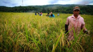
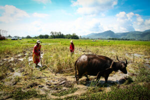
Despite this significance, agricultural development in Odisha faces multiple challenges, notably maximizing productive land use during the crucial rabi season. A substantial portion of cultivable land remains fallow post-kharif (monsoon) rice harvest, mainly due to five major factors: (1) lack of irrigation, mostly in the plateaus and tablelands; (2) waterlogging due to stagnant water in coastal lowland areas; (3) high soil or water salinity in the coastal zone area; (4) late harvest of the kharif crop or excessive soil wetting after harvest leading to late planting and low productivity of rabi crops; and (5) factors such as labour shortage, seasonal migration, lack of awareness, credit market, open grazing, among others. These fallows are depriving rural communities of potential livelihood and food security gains.
Bringing fallow lands under rabi cultivation could significantly boost food production and enhance rural livelihoods. In particular, the use of geospatial technologies such as Geographic Information Systems (GIS), satellite-based crop monitoring, and mapping enables precise identification and management of suitable rabi fallow areas. These tools support targeted interventions, rational allocation of resources, and evidence-based policy formulation for maximizing land productivity and minimizing fallows across varied agro-ecologies in Odisha.
Satellite-based mapping: Quantifying the potential fallows
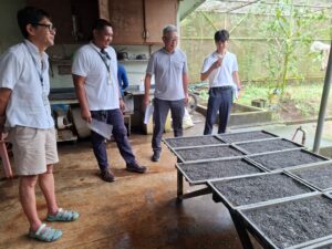
In collaboration with the Department of Agriculture and Farmers’ Empowerment (DAFE), Government of Odisha, the International Rice Research Institute (IRRI) has undertaken advanced geospatial approaches to promote intensification in rice fallow areas. This study highlights the application of multi-source satellite datasets to translate Earth Observation (EO) information into site-specific recommendations for sustainable agricultural planning.
Temporal Sentinel-1 SAR data were utilized to delineate the kharif rice extent, with the help of 800 ground truth points, which was estimated at approximately 3.6 million hectares across 30 districts of Odisha. To assess post-kharif land use dynamics, high-resolution EO datasets, including Sentinel and Harmonized Landsat-Sentinel (HLS) satellite data, and 1150 ground truth points were employed to distinguish between rabi cropped and fallow areas. Furthermore, rabi crop suitability zones for demonstration sites were delineated using soil moisture information derived from Soil Moisture Active Passive (SMAP) and Earth Observation Satellite (EOS)-4 missions. These combined datasets provide a robust framework for monitoring seasonal transitions, quantifying rice fallows, and guiding interventions aimed at enhancing cropping intensity and ensuring resource-efficient agricultural development.
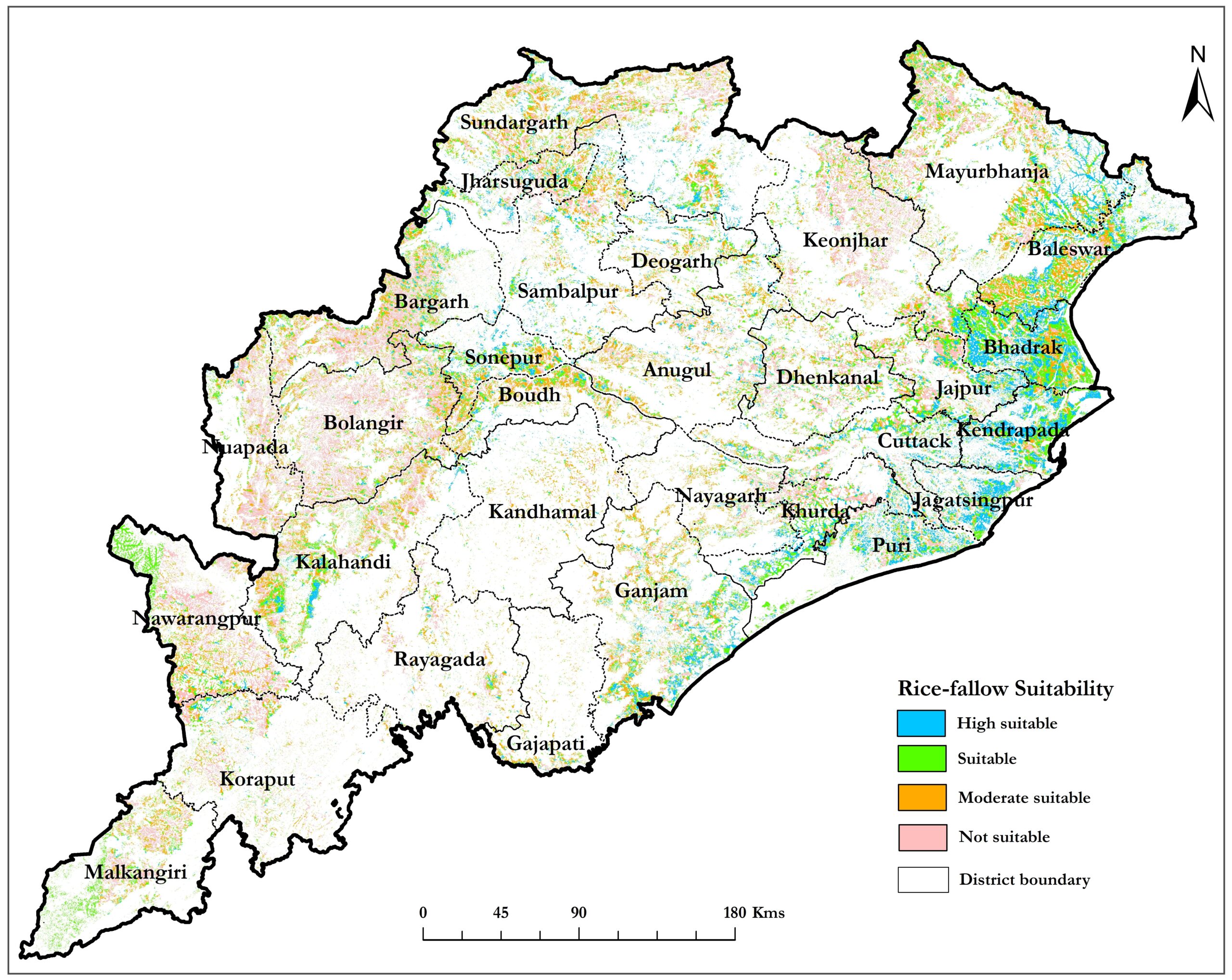
Satellite-based analysis identified 48% of rice fallow lands as potential area for intervention, with suitability for rabi cultivation stratified into four distinct classes: Highly Suitable (19.6%), Suitable (28.3%), Moderately Suitable (25.8%), and Not Suitable (26.2%). The classification was derived from residual soil moisture availability and duration post kharif rice harvest, providing a spatially explicit basis for targeted crop intensification strategies. The block‑level suitability insights guided seed dissemination, demonstration placement, and moisture-based targeting under different Rice Fallow Management (RFM) schemes.
Geospatial tracking of demonstrations: Linking technology to field reality
DAFE implemented cluster demonstrations covering 4.5 lakh hectares of rabi pulses and oilseeds under the Comprehensive Rice Fallow Management (CRFM) and Targeting Rice Fallow Areas (TRFA) schemes across all 30 districts of Odisha during the 2024–25 rabi season. The demonstration blocks were selected based on rice fallow suitability areas identified by IRRI through satellite-based mapping. During the season, DAFE conducted 4,445 geotagged demonstrations over approximately 1.95 lakh ha. in 12 districts using the e-Demonstration application, while the remaining 2.55 lakh ha. demonstrations were undertaken by CGIAR organizations and partner institutes. Analysis showed that 72% (≈3,200 sites, 1,40,400 ha.) of all geotagged demonstrations were located within mapped rice-fallow areas, and 80% (≈2,560 sites, 1,12,320 ha.) of these fell inside highly suitable zones classified based on residual soil-moisture conditions. This strong alignment highlights high placement precision, supporting effective seed dissemination, farmer outreach, and extension planning in areas with the highest likelihood of successful rabi establishment.
Satellite monitoring further helped verify crop emergence and season progress at Gram Panchayat/Village levels and contributed to refining soil-moisture based targeting for rabi 2025–26.
Spatial mapping of CRFM cluster demonstration sites 2024-25 overlayed on Rice-fallows Suitable areas
Out of the 12 demonstration implemented districts of DAFE, five districts (Ganjam, Bolangir, Baleswar, Kalahandi, and Dhenkanal) were selected for satellite-based monitoring.
In these five districts, a total of 1,963 demonstrations were carried out, covering nearly 81,000 hectares under kharif rice and other crops. Specifically, 1,427 demonstrations were conducted on 57,000 hectares under the kharif rice-fallow system. Satellite imagery successfully captured close to 90% of the demonstration area, with monitoring accuracies of 90% in Baleswar, 91% in Bolangir, 70% in Dhenkanal, 86% in Ganjam, and 82% in Kalahandi.
Spatial maps of Kharif rice area, Soil moisture suitability and rabi crop areas
Path to intensification and way forward
The Odisha rice-fallow optimization initiative has emerged as a national model for harnessing geospatial intelligence to accelerate double cropping and reduce fallows across the state. As Odisha advances toward maximizing land-use efficiency and climate-resilient production, the integration of satellite analytics and Decision Support System (DSS)-driven decision-making will remain central to improving productivity, strengthening adaptation to climatic variability, and enhancing rural livelihoods.
Building on the 2024–25 achievements, more than 5 lakh hectares were brought under rabi pulse and oil seeds, the ongoing work will now focus on operationalizing a Web-GIS–based DSS to enable real-time monitoring and refined soil-moisture-based targeting for rabi 2025–26 demonstrations at Gram Panchayat and Village levels. This capability will support more precise cluster selection, seed allocation, and extension planning, ensuring that interventions reach areas with the highest probability of successful rabi establishment. The Odisha model offers a scalable blueprint for rice-fallow intensification in other states with similar production ecologies, including Assam, Jharkhand, Chhattisgarh, West Bengal, and Eastern Uttar Pradesh.