Precision agriculture will play an important role in increasing the reach and operations of the Pradhan Mantri Fasal Bima Yojana (PMFBY), according to experts.
PMFBY is the government-sponsored crop insurance scheme that integrates multiple stakeholders on a single platform.
The use of historical and real-time satellite imagery, UAVs, remote-sensing-based crop health monitoring, crop acreage, and crop yield estimates, among others, will also be crucial for the agriculture sector.
Read the story at Business Standard
More on crop insurance:
Odisha’s farmers cope with climate risks using crop insurance
In 2019, IRRI led an educational intervention in 15 districts covering 300 villages in Odisha to create awareness and increase farmers’ adoption of risk mitigation strategies. In Ganjam District alone, 290 farmers from 29 villages participated in the crop insurance orientation program.
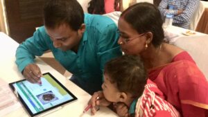
Because of the low literacy rate among farmers, IRRI used a short film on PMFBY that was quite effective in communicating the message to the farmers. An animated mobile app was also designed to give farmers a virtual experience in different situations under which crop insurance and STRVs can help farmers comprehend the relative benefits and make meaningful decisions.
Accelerating adoption of climate risk management strategies by Odisha Farmers
IRRI in collaboration with the Department of Agriculture and Farmers’ Empowerment (DAFE), Government of Odisha, aimed to support smallholder farmers through developing and making available cutting edge science and technologies under the project “Increasing Productivity of Rice-based Cropping Systems and Farmer’s Income” to enhance their resilience in the light of climate change.
One of the objectives of the project is to develop socially acceptable crop insurance as one of the social safety net interventions to mitigate risks in rice production. Crop insurance helps secure and stabilize farm incomes by protecting against crop losses due to climatic risks. Providing a financial safety net through insuring against crop loss is expected to spur farm investment, innovations, and adoption of technologies such as improved seeds, use of chemical fertilizers, machinery, etc.
Eyes In The Sky, Farmers Rest Insured
What delays the claim settlement process is the time-consuming and cumbersome process of crop loss assessment which identifies crop area affected and harvested yield, through a large number of crop cuts in selected Gram Panchayats (GPs). Technology can help to generate faster estimates of crop loss using “eyes in the sky”. These optical or radar (microwave) imaging systems onboard satellites repeatedly scan the land surface at a resolution that is good enough to capture the changes occurring on the ground at field level.
IRRI, working with the Government of Odisha, maps rice areas, monitors crop growth, estimates paddy yields, and assesses damages caused by adverse weather events like droughts and floods, using a combination of Synthetic Aperture Radar (SAR) images and crop growth models.

